
 TerraPlan
Add a background photo or satellite image
Put a photo, county sketch, PDF plan or the satellite view of the address behind your drawing, set its scale, and trace over it.
A picture behind the drawing gives you something to trace: a photo of a hand sketch, a county record, the first page of a PDF plan, or the satellite view of the house for a site plan. The picture stays on its page and isn't printed.
Add a photo or PDF
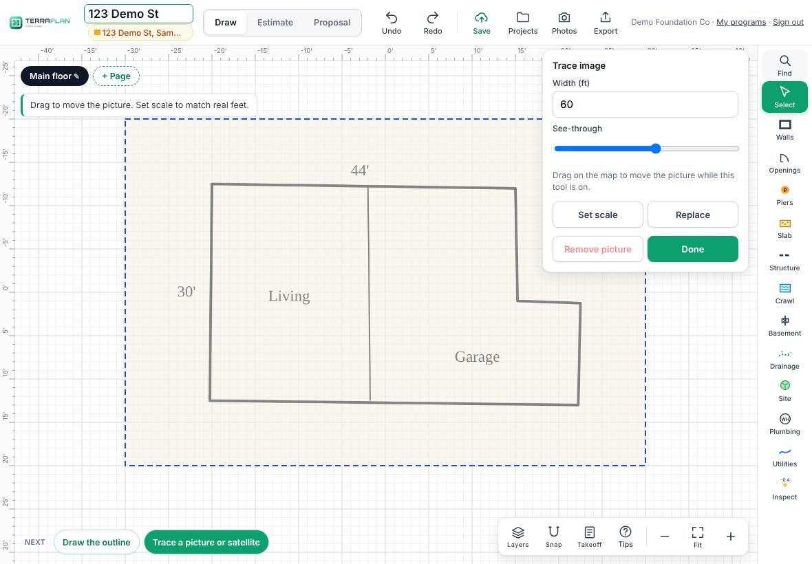
- Tap Select in the tool rail, then Trace image. (Or tap Trace a picture or satellite under Next on a blank plan.)
- Tap Choose picture or PDF and pick the file. On a phone or iPad you can take a photo.
- The picture appears 60 ft wide. Drag on the plan to move it while this tool is on.
- Set the scale: tap Set scale, tap two points on the picture you know the distance between, and type the real distance (for example 44').
- Use See-through to fade the picture so your lines stand out.
- Tap Done and draw your walls over it.
Add the satellite view
- Make sure the plan has the job address (tap Add address under the plan name).
- Tap Select, then Trace image, then Satellite view of the address.
- TerraPlan looks up the address and puts the satellite picture behind the plan, already to scale.
- Drag it so your walls sit on the house, then tap Done.
Change or remove the picture
Tap Select, then Trace image again:
- Width (ft) sets the picture's width directly.
- Replace picks a different picture.
- Remove picture takes it off this page.
Was this article helpful?
Thanks for letting us know.
Still need help?
Send us a message and a real person on the Terralox team will get back to you, usually the same business day.