
 TerraScan
 overview
What TerraScan is for, and a tour of the Home, Map, Properties, Programs and Team screens and the property workspace.
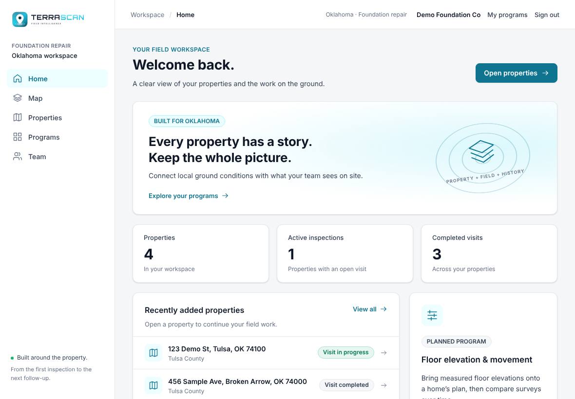
TerraScan is the field workspace built around the property. For each address it pulls in the ground conditions (soil shrink-swell, flood zone, geology, drought and more), lets your inspector log what they find on a site visit, and turns it into PDF reports.
Open it from your programs page or go to /terrascan/app.
The left menu
| Menu item | What it's for |
|---|---|
| Home | Counts of your properties, active inspections and completed visits, plus the properties added most recently. |
| Map | A map of any area. Turn on layers, click a spot to see What's here, and press Add as property to save it. |
| Properties | The list of every property. Search, filter and add new ones here. |
| Programs | The TerraScan tools that are available now and the ones that are planned. |
| Team | Who is in your workspace. Roles come from your Terralox account: owners and managers are admins here. Change roles on the Team tab of My account. |
Your company name, My programs (back to your Terralox programs page) and Sign out are at the top right. The Terralox button at the far top left goes to the terralox.com home page; tap the small arrow next to it for My account, Jobs, your other programs, the Help Center and Sign out. The TerraScan logo next to it goes to TerraScan's Home.
The property workspace
Open a property from Properties to get its workspace. The bar across the top shows the address, county and foundation type, and these buttons:

- Diagnose: ranked likely causes from the ground data plus what you see. See Diagnose a property.
- Draw plan: opens the property in TerraPlan (only if your company has TerraPlan).
- Measure and Draw Boundary: map tools. See Measure and draw the property boundary.
- Download Property PDF (Property PDF on a phone): the property report. See Download TerraScan reports.
On an iPad or a narrow window the buttons wrap onto a second row, so every one stays on screen.
Under the address, Job in: links to the same job in TerraPlan or TerraCam.
Below the bar:
- Site Visit on the left, for logging pins on the map. It opens the visit that's in progress, and ← All visits lists earlier ones.
- Layers over the map, for turning ground data on and off.
- Site Plans and Photos cards on the right, for a plan picture to lay on the map and general photos of the property.
Related questions
Does TerraScan work for any address?
The ground layers are built for Oklahoma. Some layers, such as parcel and owner details, depend on what each county publishes.
Thanks for letting us know.
Still need help?
Send us a message and a real person on the Terralox team will get back to you, usually the same business day.