
 TerraTopo
Enter elevation readings
Click the plan to drop each reading, edit or delete points, or import a whole list of readings at once.
Each reading is a point on the plan with its difference from your reference point, in inches. Low spots are negative numbers, for example -0.75.
Add readings by clicking
- Under 3. Click mode, make sure Mark elevation points is selected.
- Click the plan where you took a reading.
- Type the value in Elevation (inches), for example
-0.75. - Add a Note (optional), for example "visible crack".
- Click Save. The heatmap redraws.
- Repeat for every reading.
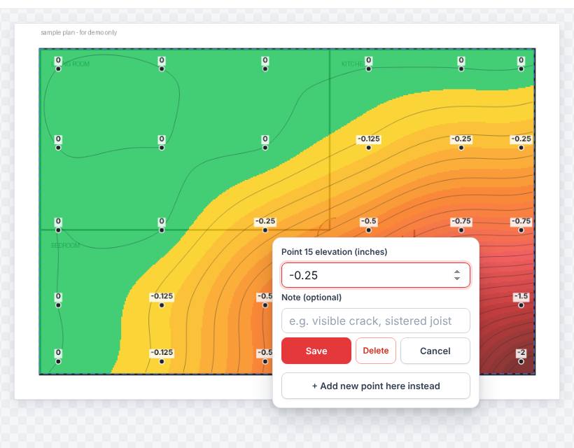
Edit or delete a reading
- Click the point's marker on the plan.
- Change the value or note and click Save, or click Delete.
- To drop a new point right next to it instead, click + Add new point here instead.
Every reading is also listed under 7. Elevation points. Clear all points removes them all.
Import a list of readings
If your readings are already in a list, import them under 6. Import readings.
- Pick a Format:
- List of values — assign by clicking points in order: one value per line. After loading, click the matching spot on the plan for each reading. Use Skip this reading or Stop assigning as needed.
- CSV with coordinates (x%, y%, value[, note]): each line places itself.
- Paste the list in the box, or choose a .csv or .txt file.
- Click Load list.
Place an even grid of points
- Draw the floor outline and set the scale first (see Outlines, walls and scale).
- Under 5. Scale & auto-grid, set Grid spacing (ft).
- Click Generate grid points in outline(s).
- Click each grid point and type its reading.
Related questions
What should 0 be?
Your reference point, usually the highest spot or a spot you know hasn't moved. Green on the heatmap is at or above it.
Was this article helpful?
Thanks for letting us know.
Still need help?
Send us a message and a real person on the Terralox team will get back to you, usually the same business day.